About Us

Welcome to our blog, describing our voyage aboard the two BRAVO's; the first boat a Kelly Peterson 46 with homeport in Seattle, Washington. The second is a Boreal 52, launched in Treguier, France in February 2020.

We headed south from Seattle in 2010, and have been voyaging in one form or another since. Cheers, Adam and Cindi


"As for me, I am tormented by an everlasting itch for things remote. I love to sail forbidden seas, and land on barbarous coasts." -Herman Melville, 1844


Thursday, December 29, 2016

Rocking and rolling down the WA coast.......PART ONE

WA = Western Australia.......

Well, we know it's been a while since the last update.  Sorry about that, we have been putting on some miles, and haven't really stopped in one place long enough to post.  Our bad!!!

This post will just hit on some highlights of the last 3 months......  Big picture, we continued down the  coast of WA to Perth, where we left Tojo at a friend of friends Don and Deb while we traveled to New Zealand to check on Bravo, then to Seattle for a quick Thanksgiving visit, and back to Perth, where we've resumed our land travels down the coast and will soon be in the desert again heading east.  Here's a bit more shade and color, told mostly through photos......

Leaving the Pilbara, we headed west to the coast to explore the Exmouth area, home of the Cape Range National Park and the famous Ningaloo reef.  The area is a World Heritage site, known for one of the longest fringing reefs in the world, providing great habitat for corals, mantas, whales, and other fishy critters.  It was calling our names!!!

Exmouth has started a new program this year, where divers are permitted to swim with visiting humpback whales.  After getting skunked on our attempted whale swim in Tonga a couple of years ago, we were eager to give it another go.  Unfortunately the season was ending when we arrived, as most of the whales had headed south to antarctica for the summer.  We did sign up for a manta snorkel trip anyway, as we wanted to explore the reef, and swimming w/ mantas is always a treat.

On the ride out, we did pass a couple of whales, oh well, maybe next time!!!


The boat was quickly able to put us into the water with mantas, as they use a spotting plane to find the rascals.  After several runs with the rays, we were heading back to shore when the skipper spotted a huge loggerhead turtle.


Adam getting up close and personal with Mr. Loggerhead.

Listed as endangered around the world, they're an uncommon species of turtle, at least in these waters, and we all jumped in to check him out.  Fantastic to swim with the elder statesman, who's head was as big around as my leg.

We then headed down to Cape Range, a stunning park within the Ningaloo Reef.  Had a terrific time camping in sites on the beach and exploring the area for about a week.


Solving the world's problems with a bunch of fellow denizens of the reef.


Turtle porn:  One day this happy couple swept past our camp.  No need to rush too fast for the camera, these characters know how to take their time.


Emus were a common sight in Exmouth, this one wandered past our downtown campsite.


After Exmouth we drove down to the little tourist town of Coral Bay, also within the Ningaloo Reef.  Here we signed up for a couple of scuba dives with a local dive boat.  Though due to the cooler water the coral was perhaps not quite as spectacular as that in Fiji and the other tropical places we've been, there was a good variety of fish and we saw some new (to us) species, such as a wobbegong shark, sailfin catfish, frog fish, and lots of different nudibranchs.  The guides were great, and we had a terrific day.  Nice to get out on and under the water again!!!


The next big stop was Steep Point, the westernmost point of mainland Australia, accessible only by 4 wheel drive.  The area is famous for its beach driving, cliffs, ship wrecks, and dramatic beach landscapes.  It didn't disappoint !!!


The cliffs are famous for radical rock fishing, yielding many record catches.  It's radical indeed, with fisherman roping up with climbing gear to keep from falling in.  Now and then, the sea claims another.....


Fishing anchorage spot


Cliff at the point is apparently a popular fishing spot!!!!!


Zuytdorp Cliffs, site of the wreck of the Zuytdorp, an 18th century trading ship of the Dutch East India Trading Company.


The life ring seemed a bit of a joke, given the likelihood of a rescue's happy outcome up the cliffs.


The beach went on for miles


Staying in the Shark Bay area, we headed up the 4wd tracks to Cape Peron and the Francois Peron National Park for a few days.  The whole Shark Bay area was full of great hiking and interesting sites to explore, such as this huge colony of cormorants.


Shell beach.....the entire beach is made up not of sand, but of billions of tiny, fingernail sized shells


The shells formed a dense conglomeration used by the early settlers of the area as building blocks.  This was a typical quarry.

Boardwalk at Hamelin Bay


We headed south to the surf town of Kalbarri and the Kalbarri National Park.  Great surfing in the area!!!


The road passed by this whacky pink lake.....apparently made pink by algae, and hosting a commercial harvest industry of tiny brine shrimp.  (Wondered where those "sea monkeys" of comic book and Southpark fame came from???  Thought so.....)


At last we arrived at the outskirts of Perth, and found a classic little park, Yanchep National Park, which allowed camping.  Great critters, with wild kangaroos hopping around the campsite, and a recovery center for injured koala bears.  Nice way to wrap up this leg of the trip!

Awwwwwww.......


Mama roo w/ joey.   The little guy looks like he's about ready to start university!!!


Koalas can be nasty.....we didn't want to mess with this bad boy!!!


So let's call this a wrap on Part One of the WA Coast so we can get something posted.  Will try to pick it up shortly, as we continue south of Perth.  Lots more to come, so stay tuned!!!  Happy holidays to all, or "Happy Chrissie", as a proper Aussie would say!!!

Thursday, September 22, 2016

Mining our own business in the Pilbara

WARNING:  MANY PIXELS WERE KILLED IN THE PREPARATION OF THIS POST !!!

Leaving Broome, team Tojo was itching to get back bush.....back into the more remote desert region known as the Pilbara.  Located between the Indian Ocean and the Great Sandy Desert, the huge sparsely populated region is home to some of Australia's most undeveloped back country, as well as the heart of the Australian ore mining industry.  The national parks are equally large, such as isolated Karlamilyi (formerly Rudall River) national park, second largest in Australia, and Karijini, home of spectacular gorges and landscapes.


We headed south to camp at 80 mile beach.  While we can't vouch for it's claimed length, we can vouch for the difficulty of catching fish from it!!!  That said, it's a beautiful stretch of virtually unpopulated sand, and we enjoyed a couple of nights there before pointing our bull bar inland.  We quickly left the pavement, driving east toward Karlamilyi National Park.  The desolate road took us deep into mining country, with the topo map showing a myriad of unmarked desert tracks branching off to past and current smaller mining operations.

After spending a nice night at Carawine Gorge, we entered the world of the Telfer Mining Co., receiving a permit to traverse their gravel track into the back of the Karlamilyi Park.


This park was like none we'd ever seen.  No paved roads, no signs (including at the "entrance"), no facilities.  Just the way we like it!!!

As soon as we left the Telfer property, crossing into the park, we found ourselves on an 18km gnarly rock track, heading deeper into the bush to a spot alluringly known on the map as "Queens Pool".  Called our names!!!  The track was a decent pair of wheel ruts in some places, and basically a boulder field in others.  We let our tires down, and our trusty steed Tojo made it without a hitch....Sweet!

Tojo camp at Queens Pools
At the end of the track we came to a couple of cleared spots to camp, one was already occupied.  No worries.  We made camp in the other, a beautiful spot, and hiked up a sort of goat track, going to a succession of nice, COLD little rock swimming holes.  Fantastic!


Views from the campsite were beautiful...


And the pools even better!!!


After a couple of days exploring the 5 pools, we headed back down the track to see what the rest of the park had to offer.


Unfortunately the clouds looked threatening, and we got a bit of a drizzle.  The dirt tracks of the park can become impassable for days after a good rain, so after checking out a few other tracks around the park, finding some other beautiful photo spots, we decided to beat feet and go out the southern side of the park, onto a better dirt/gravel road.

On this road, we saw a spot marked as ok for camping on our 4x4 map, and as it was getting late, we pulled off onto a dirt track as marked.  This was a really desolate spot, we hadn't passed another vehicle all day, just the kind of place we love.  So we made camp, and as we were enjoying a couple of coldies in the fading light, at the same moment, we both noticed a couple of BIG ants.....REALLY BIG ants.  (later research showed them as "bull ants")

Bull ant (internet photo).....check out the bloody pincers on these bad boys!!!

Next thing you know we see a few others, no big deal, what are a few ants, even if they're over an inch, say 30mm long?  Adam tried to step on one.  The bugger acted like he didn't even feel a size 12 stomp from above, just shook his now dusty head, looked up, and laughed....."Is that all you got, big fella?"

By now, there were perhaps 30 or 40, all around us.  Time for stronger stuff.  Adam got out a big ball peen hammer, and tried pounding the buggers into the dirt.....same thing happened.  Even after being pounded a couple of inches into the sand, they'd rise up their pincers from the dust and give us what I'm sure was a nasty ant sneer.  There was just no way to kill the bastards.

A few minutes went by.  They were now all over the place.  Hundreds of them had appeared, all around us.  Cindi got bitten by one on the leg, and was in a world of hurt!  Even though the tent was already deployed on the roof, we tried moving about 50' away.  It appeared to be an ant free zone.  Not to be.....they WERE FOLLOWING US.  It was just like a zombie movie, there was no killing them, and every time we'd try to whack one into the ground, it seemed like 2 or more appeared.  Got pretty intense.  We were their prey.  We finally drove (w/tent still up!!!) a couple hundred meters down the track, and finally that was the end of the ant saga for the night (though the big flying beetles began in ernest to attack our lights, banging into us in the process.....BIG but harmless, and the beetle fillets fried up nicely with a bottle of shiraz!!!)

Cindi relaxes the morning after the zombie bull ant attack

Here's what AustralianMuseum.com has to say about bull ants, these sons-a-bitches of the insect kingdom:

"They attack intruders of any size that come too close to their nest. Bull ants also have well-developed vision and will follow or even chase an intruder a good distance from the nest. Usually the sight of large aggressive ants streaming out of the nest is enough to prompt a hasty retreat. If not, the ants deliver painful stings by gripping the intruder with their mandibles (jaws), curling their abdomen to reveal the sting and injecting the victim with venom. Often multiple stings are delivered."

So much for this brush with Australian bugs, most of which, it seems, can inflict serious pain on their prey (us).

The next day we continued down the Talawana track to the mining town of Newman, home of the Mount Whaleback Mine, the biggest iron ore mine in the southern hemisphere.  Newman is the nondescript company town, built when the mine began in the late 60's.  Not much here that isn't related to the work of the mine, which has been raping and pillaging the Pilbarra for over 40 years, and supposedly has about 20 years to go.  We like wikipedia's view of the architectural style of the town:  

"Being founded in the 1960s, Newman's architecture reflects the modernist styles of that decade and the next, being predominantly functional and devoid of detail or embellishment."

They were being kind!!!

After a few quick hours resupplying in Newman (it wasn't easy to find decent wine in the town, that's for sure!!!), we boogied out as quickly as possible and headed NW to Karijini National Park.

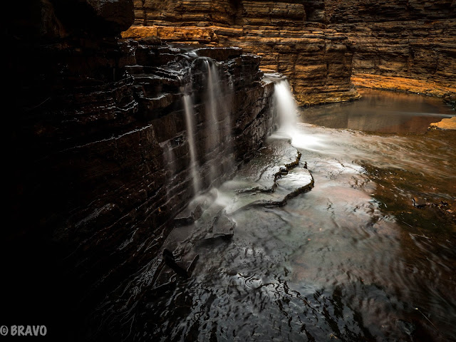
This beautiful park is home to some spectacular gorges and canyons, and several are accessible via hiking trails of various length and challenge.  A few also offer a reward of a swim in a beautiful swimming hole for your efforts.  We like it.

Here are a few shots of this spectacular landscape:


Cindi swims through to the next gorge....Adam carried the camera gear along the ledges


Karijini really delivered the goods.....the 3 days we spent in the park really wasn't nearly enough time!


Leaving Karijini, we headed into Tom Price, another mining company town, for resupply.  Much like Newman, TP was built in the 60's/70's to house the employees of the Tom Price mine, owned by mining giant Rio Tinto.  While here, we decided to take a tour of the big mine.  The scale of the entire operation was rather unbelievable.  In digging the ore, Rio Tinto has completely removed an entire mountain, not to even mention the hole beneath where it used to live.  It was unsettling to see how little concern was given to any ecological effects, and absolutely no mention of the impact the mines have on the local aboriginal original inhabitants of the region.  Clearly money talks with a loud voice in the Pilbarra, as it does in so much of the world.  And ore here is huge money.  In 2009 the mine produced nearly 13% of the world's iron ore.  It is now producing 28 million tons per year, and is expected to continue production for 20 more years.  The ore is all shipped via private railway line to the coast, where it is loaded on ships to smelters around the world.  (even the trains are amazing, nearly 2 km long!!!)

View into the pit.  There used to be a mountain on top of this.

Mine from an overlook over the town.  Pit is in the background


Leaving Tom Price we headed to our final park of the Pilbara, Millstream Chichester National Park.  Compared to its neighbor Karijini the park is little known.  It was a bit quirky and offered some great 4wd tracks and beautiful remote landscapes, as well as lots of wildlife.  


It's wildflower season in the Pilbara


Saw a bizarre rock formation on the cliff above one of our camps.  Check out the bright circle below. The blowup is in the following photo.  We have no idea how it got there!!!  Any ideas???


How did it get there, how does it stay?  Like kids building blocks!!!

One evening we had a fun visit in our campsite from a small kangaroo, known as a euro.  As we sat quietly taking photos, the little gal (w/ joey in pouch) just kept munching the grasses and scrub around us.  She stayed with us for about 30 minutes, until it was nearly dark, then hopped away into the bush.


So that wraps up our swing through the Pilbara region of the western Australian outback.  It was a magical place, a region of huge contrasts between the vast natural beauty of the desert landscapes and the harsh reality of the costs to the environment of the myriad of mineral extraction operations throughout the area.  We could have spent a lot more time exploring, but the coast is beckoning.....stay tuned!